The poetry you view here are works in progress. The poems will go through several revisions which may take months or even years.
OUZEL
The constant squatting,
a dance to the gurgle
of miniature waterfalls;
the Dipper disappears
by diving, then bounces
up out of the water
dry as charcoal.
He hops from rock to rock,
and checks moist mats of moss
for meals of midges,
stoneflies, caddis, and mayfly nymphs.
The Ouzel, like an aquatic insect,
emerges from the water,
sprouts wings, and flies away.
CREEKSIDE
The flowing water calls out
from rocks of color,
where trout hide,
and sun flies back to heaven;
where the constant ring
of ripples, runs, and cascades
roll through time and space
and never stops.
From a hundred miles away,
it still sings.
EARLY STORM
This morning, sunlit salmon clouds
migrated across sky seas,
weaving through dark, cold rapids
trying to get back to their place of origin.
When they hit the rapids,
rumblings shook moisture to the ground,
and bright glare glanced off their skin
connecting earth and heaven.
THE LIBRARY PARKING LOT IN FALL
In the summer it's just black,
and most often hot and dry.
White paint provides places of order,
a border, and stay within the lines, please.
In autumn, the artist always works.
Branching palettes of crimson, yellow, and orange,
await the crosshatching strokes of gentle breezes.
Paint is tossed in the air.
The wind lays layers of lacquered leaves,
sealed by rain upon an asphalt canvas,
blending color upon the plainness,
and providing art for a season.
A DAY IN THE BASIN
All is quiet, except for the sound
of warm air heated by solar light
rising up past my ears.
Then, the crunch of boots pressing down
on dry grass, the snap of aspen branches,
and the startled flashes of red wings clacking against
a backdrop of green and gold.
These are not the sounds I seek,
or the vision of color for my eyes.
Moving forward, I hear my way over beaver-hewn logs,
stopping in small clearings, tasks to perform.
Connected ferrules of graphite become an extension of my arm:
Can I touch the sky and stir the clouds?
A spool of amber locked into place
while loose coils fall to the ground,
chaos before control.
Monofilament is threaded through snake guides,
the quick click, click, click of metallic drag
is a locust whisper waiting for reply.
Through an opening in peach-leaf willows the world changes.
The sky is yellow and the landscape blue.
Rich pine is oxygen.
There is a connection between arching rod,
tight line, and wild crimson slashes.
Life and death in my hands.
Some have predicted I will die in a place like this,
swift and sweet.
Right now, I come here to live.
Friday, December 24, 2010
Thursday, December 16, 2010
NOTICING
I'm the kind of person who jumps from one interest to the other. The only thing that has held my interest in a constant manner is fly fishing and fly tying. Some how, these two things got in my blood at an early age and have stayed with me. Other interests tend to come and go, then gain my interest again after months or years.
I've had an interest in poetry for a long time, but never seriously studied it. A few months ago I decided to do some poetry study and reading. I have been checking out arm loads of poetry books from the county library. Some of the poets I struggle reading. I have read poems by poets that seem to be nothing more than drunks throwing words on a page. The words and sentences make me squint like I'm looking into the sun; I want to turn my head and look away. If these poet's purpose is to confuse, then they have succeeded with me. I often find myself shaking my head and asking what and why?
I have found some poets and poems that I do enjoy. I enjoy many of those who have written poems about nature. I love the imagery that these poets use. I like the poems that help me see, hear, smell, and taste the things they write about. I like the poems that make sense. I'm not opposed to trying to figure something out, but too much poetry that is more like some type of riddle can make me think too much when I'm not in the mood to think. Sometimes I want to read poetry to feel the words, to hear them roll around in my brain, to see in my imagination what I see when I read the words. I have the same problem when it comes to card and board games. If it is a game where I have to think too much, then it's not as fun and relaxing to me. I want to play the games of chance; roll the dice and take the results. Then there is no ego involved and the smartest and fastest don't always win. I don't mind reading poetry that makes me think and feel, but the simple stuff that is easy to understand is what I like right now.
Along with the reading and studying of poetry comes the desire to write it. I have written a few poems (or what I thought were poems) over the years. I have this desire to write more now. I have been looking for ideas and with my love of the natural world, that is where I look for and often find inspiration or ideas for what I want to write. I find myself looking and trying to see things in more detail. I think I am beginning to notice things that I have taken for granted in the past.
The last few days as I have driven to work, I have noticed an amazing thing. As I drive east towards the mountains at 7:45 AM, the sun at this time of year is still behind the mountain range. The light from the sun provides a glowing backdrop. This glowing, as I call it, changes color, depending on atmospheric conditions. If there are high clouds, the glowing can be a warm color, somewhere in the spectrum of yellow, orange or red. If the atmosphere is bright, clean, and clear, the glowing is more to the blue spectrum. If cumulus clouds are hanging around the mountains the bottoms are usually a pale mauve or deeper purple color. If stratus or cirrus clouds are present, they can take on several colors. I've seen them look the color of pink salmon meat or purple cotton candy.
Lately, what has stood out is the way the sunlight at that time (7:45 AM), taps the tops of each high peak along the mountain range. I can't see the sun because it is still below the mountains. The mountains stand as giant shadows of darkness with just enough dawn light to make out the faintest of details. The light from the sun, however, shoots through some of the back canyons and illuminates the very tips of the peaks all along the front range. My eyes follow the highlights along the tops of the ridges jumping from one peak to the next until I am slapped awake with the light that grasps the majority of one of the prominent peaks and rock faces on the north end of the mountain range. This peak and its rocks are covered with snow. The sun's focused light makes it stand out in clean brilliance. I can't stop my eyes from following the sun's rays skipping along the ridges and teasing me to follow until my eyes and the sun's light slam into the rock face of this majestic mountain. I have lived here my whole life, but my search for ideas and inspiration for a poem have opened my eyes in a "new" way. I like it.
I have a plain paper journal that I will be using to write down the things that I see, hear, smell, taste, and feel as I wander around, or just drive to work. When I get brave, I will share some of these things on this blog. Maybe the musings will turn into poetry.
Friday, November 26, 2010
Winter Tricks
Winter came blasting in on Tuesday afternoon. The prediction was for a blizzard. The snow rode in on some good wind, and it was cold, but the actaul snow (at least in my area) was only about an inch deep. To be honest, I've seen worse storms. The snow storms that hang out for a day or two and pile up valley snow are the ones I dislike. My back is getting too brittle and weak for the shoveling.
It is cold. The Arctic air associated with this storm is bitter and a month or two early. I'm looking at two options this winter: a long and cold winter, or an early winter with an early spring. I bet you can't guess the one I'm hoping for.
Time to trick my mind. I'm going to listen to some good Hawaiian music. Let's see where are those lyrics:
Palehua
E kahea mai ana
'O Palehua e
Wahi lani ha 'ole
Ke kuahiwi kaulana
Wehe i ka lani
'Auhea wale ana 'oe
'O Palehua e
Calling to me
Is Palehua
A heavenly place
Unforgettable
Famous mountain
Unveiled to the heavens
Hear my call
Oh Palehua
---words by Amy Hanaiali'i
Sunday, November 7, 2010
WHITE ROCK BAY LOOP (ANTELOPE ISLAND)
 |
| Rock solid hikers. |
Antelope Island State Park is close to the cities along the Wasatch Front. Within a half hours time we were unloading and preparing to hit the trail head. Our original idea was to hike 2.6 miles to the top of Beacon Knob. At the top of the knob we would raise a group flag, eat a light lunch of sandwiches, chips, and cookies, take in the views, and then hike back down. Each hiker was to carry a portion of the lunch and was responsible to bring their own water bottle with water.
I was so excited to get the group hiking that I misread the map and lead the group out into the White Rock Bay area. This trail would still lead us up to Beacon Knob, but it would add 2.5 more miles to the hike. When I realized my error, I stopped the group and asked them to vote on our options. We could continue around the loop or we could hike to the ridge below Dooley Knob and hike back out the same way. The group voted to hike the loop.
It was a perfect day. The morning chill was soon toasted away by sun peeking out through layers of high clouds. Within minutes of hiking, jackets and sweat shirts were shed and water bottles were being emptied.
I was impressed with the attitude of the younger hikers. Not one of the hikers complained about the added distance to our hike and everyone seemed to enjoy being outdoors.
 |
| Raising of the flag. |
The view from our lunchroom was wonderful. We could see to the east and view most of the Wasatch Front mountains from Brigham City to Salt Lake City. To the west was vast areas of the Great Salt Lake and western mountain ranges in the west desert. The White Rock bay valley we hiked through gave us a good perspective on how far we had hiked. The straw-colored valley was dotted with the visible dots of antelope which provided smiles and a realization that the island was named right.
 |
| Looking back at the Wasatch Front from Antelope Island |
 |
| Hiking toward Beacon Knob |
We hiked down through a rocky hillside and eventually picked up the trail again. The trail head where we had parked was now in sight. When we got to the trail head where we started I looked at the map again read the mileage of the White Rock Bay loop was 7.5 miles. I figured with the shortcut caused by the bison that we cut out about 1/2 mile so our complete hike was 7 miles total.
 |
| Bison |
Sunday, October 17, 2010
ALTITUDE! MOUNT OGDEN HIKE 5100' TO 9572' IN 6 MILES.
"I'm going to dance down the top of this ridge!" I yelled to my wife. I did a few fancy steps, threw my arms in the air and ended with a worn-out grandgete. My wife then followed and danced her way down a section of the Mount Ogden saddle. We both had dreams of dancing across the mountains and this effort would fulfill that dream. The dance moves were part of our veneration to the mountain. We reached our goal to make it to the peak and had to let the exhilaration we felt fly, if only for a moment, off the tops of those ridges.
Our hike began at the trail head near 47th Street in the South Ogden foothills, just south, and a little above the Dee Event Center. The trail is called Beus Trail but only follows the bottom of Beus canyon and its creek for a little over a mile. About a half mile into the hike a footbridge crossed Beus Creek and the trail splits. If you take the trail to the left you will come out along the face of the foothills on what is the Bonneville Shoreline Trail. To get to the summit of Mount Ogden via Beus Trail, you cross the bridge and stay in the canyon bottom with the creek.
The canyon bottom is loaded with ferns. In the early fall they are changing from lush green to straw yellow; dense and thick, they often cover the small creek and hide it from view. The only sign that it is still there is the pleasant sound of trickles and small plunge pools. Small creeks make great hiking companions and we enjoyed Beus Creek's singing as we made our way to the last crossing before heading south toward Burch Creek Canyon.
As we came up the gradual incline out of Beus Canyon our eyes were hit with a view of Burch Creek Canyon. The north facing slopes mottled with dark, rich stands of fir trees. Burch Creek Canyon looked rugged and deep on the north face. We would follow the trail on the south facing slope which was covered with scrub oak and maples. The trail had now turned to the east and would continue this direction gradually taking us near the top of Burch Creek Canyon and what looked to be a barren mountain top.
Scattered among the green oak and maple were their friends and family already preparing for a winters nap. Red and orange and yellow leaves lighted by afternoon sun added a frivolous feeling of one last party before snow and cold turned things to black and white. Hiking in the midst of such color with the warmth of the sun removed the daily stress from my soul and I began to live in this exact moment and transcend my worldly cares.
As we approached the top of Burch Creek canyon, the trees and brush gave way to mostly rocky terrain. Some small sagebrush and tufts of grass grow where they have gained a hold, but dirt and rock now called out with each footstep. I don't know my rock well, but I think I recognized granite, quartz, and maybe feldspar. Some of the rocks had twinkling's of iron pyrite that made me wonder if we were fools for hiking to the summit and back in one day. Through the summer we had talked to others about the hike trying to get details about its difficulty. Some people told us it was easier to hike to the top and then take the Snowbasin Ski Resort tram back down the opposite side. We decide that we were in shape enough to hike to the top and then come back down the same way, a twelve mile adventure. About half way to the summit, I wondered if we would make it back before dark or if we would have to turn around taking nothing for our effort but a pocket of fool's gold.
At the top of Burch Creek, the trail switches back toward the west. I could tell that a nice view of Ogden was over the next hill so I paused and took my wife's hand so we could experience the view together. We looked out over the valley and began to point out the different landmarks. The Promontory range in the western horizon stretched from north to south ending at the shores of Great Salt Lake. Fremont Island, Antelope Island, Gunnison Island, appeared as dusty patches of land floating in the hazy expanse of an inland sea.
Continuing forward and upward, we were now on the Mount Ogden Saddle. The ridge that would take us to the peak. The radio towers at the peak were now in view. This gave our hearts a boost of adrenalin and our minds a shot of faith. With the goal in sight, we knew we would make it. Our only concern was getting back down before dark.
We sat down and ate our lunch and drank water. We rested for half an hour and then started the last mile to the top.
We met two couples coming back down and exchanged pleasantries. They must have started their hike at dawn. They thought we were still about an hour away from the summit.
I loved the view from the saddle. We could look to the north and see Ben Lomond Peak, look to the west and see the Promontory Range and other western ranges, and look to the southwest and see the Oquirrh Range. To the south we could see the valley floor and towns strung out in the narrow band of land between the mountains and the waters of Great Salt Lake. We were almost too high and far away to pick out landmarks looking south but we knew we were seeing such cities as Layton, Kaysville, Farmington, Bountiful, and North Salt Lake.
Viewing north along all the mountain tops gave us a new perspective on the ruggedness of the Wasatch Front. We marveled at how quickly the mountains shoot skyward from the valley floor. I have heard people talk about how barren and colorless they seem to be. But on this hike we realized that they have their own beauty. They may not be as green and lush as mountains found in surrounding states or mountains in other parts of the country, but the Wasatch Front has a simple beauty, like a women who puts on just the right amount of make-up and dresses with simple elegance, the Wasatch Range is dressed and made up just enough to be alluring. The mountain changes with the seasons and a careful eye will certainly see the white and gray coolness of winter, the fresh greenness of spring, the warm, dry rock of summer, and the flame-orange of fall. Each season with its invitation to see glamour, to look deep into her eyes as she reveals her secrets.
The last mile or so of the trail follows just below the west facing slopes. Eventually, you turn east and hit the ridge that the summit sits on. We were a little disappointed to find at this point a rocky service road coming up from the Snowbasin side of the mountain. I knew there was some type of building at the summit, as well as the radio towers, but some type of primitive yearning in me wanted the place to be wilderness. Looking down over the ski runs and buildings of Snowbasin reminded me that we were not that far from civilization and that in the winter, the back side of Mount Ogden is a winter recreationist's haven. In about three months deep snows will bury the summit and the east slopes will be full of parka clad figures riding and sliding up and down her terrain.
We scrambled up the broken rock and made it to the building, the towers, and a helicopter landing pad. We stood on the pad and looked east viewing the Morgan Valley and its surrounding mountain ranges, then looked back to the west and viewed the Ogden Area and as far as we could see to mountains in Nevada.
There were a couple of plaques and geologic survey markers at the summit. The plaques looked to be placed there by students and faculty from Weber State University in Ogden with history of the hike. Also present at the summit is the disturbing signs of civilization--names scratched into the face of the plaques and marks made with black spray paint on the rocks.
After spending a little time for pictures from the summit, a hug, and a kiss, we decided we needed to get off the mountain before dark. We glanced one last time out over the valley, letting the wind blow through our hair. I closed my eyes for just a minute and imagined I was a hawk soaring above the ridge, dipping, spinning and quickly rising up and over each canyon. I rode the wind out of Burch Creek and into Beus Creek, then over to Strong Canyon and up Waterfall Canyon, then up into Malan's Basin and down into Taylor's Canyon. I opened my eyes and the dream was over. I had to hike out the same way I hiked in. I guess, it was the giddiness I felt from making it to the top that made me take off running along the ridge. Since I didn't have the wings to carry out the hawk dream, I did the only thing I could do--run! I looked back at my wife and that is when I realized I also had a dream to dance across the mountains. It was a dream she has had too. That's when I yelled back to her. "I'm going to dance down the top of this ridge!" And we did!
 |
| Base of Beus Canyon, the beginning of the hike. |
"I'm going to dance down the top of this ridge!" I yelled to my wife. I did a few fancy steps, threw my arms in the air and ended with a worn-out grandgete. My wife then followed and danced her way down a section of the Mount Ogden saddle. We both had dreams of dancing across the mountains and this effort would fulfill that dream. The dance moves were part of our veneration to the mountain. We reached our goal to make it to the peak and had to let the exhilaration we felt fly, if only for a moment, off the tops of those ridges.
 |
| Beus Creek looks like it comes out of this boulder. |
The canyon bottom is loaded with ferns. In the early fall they are changing from lush green to straw yellow; dense and thick, they often cover the small creek and hide it from view. The only sign that it is still there is the pleasant sound of trickles and small plunge pools. Small creeks make great hiking companions and we enjoyed Beus Creek's singing as we made our way to the last crossing before heading south toward Burch Creek Canyon.
As we came up the gradual incline out of Beus Canyon our eyes were hit with a view of Burch Creek Canyon. The north facing slopes mottled with dark, rich stands of fir trees. Burch Creek Canyon looked rugged and deep on the north face. We would follow the trail on the south facing slope which was covered with scrub oak and maples. The trail had now turned to the east and would continue this direction gradually taking us near the top of Burch Creek Canyon and what looked to be a barren mountain top.
 |
| Scrub Oak and Maple |
Scattered among the green oak and maple were their friends and family already preparing for a winters nap. Red and orange and yellow leaves lighted by afternoon sun added a frivolous feeling of one last party before snow and cold turned things to black and white. Hiking in the midst of such color with the warmth of the sun removed the daily stress from my soul and I began to live in this exact moment and transcend my worldly cares.
As we approached the top of Burch Creek canyon, the trees and brush gave way to mostly rocky terrain. Some small sagebrush and tufts of grass grow where they have gained a hold, but dirt and rock now called out with each footstep. I don't know my rock well, but I think I recognized granite, quartz, and maybe feldspar. Some of the rocks had twinkling's of iron pyrite that made me wonder if we were fools for hiking to the summit and back in one day. Through the summer we had talked to others about the hike trying to get details about its difficulty. Some people told us it was easier to hike to the top and then take the Snowbasin Ski Resort tram back down the opposite side. We decide that we were in shape enough to hike to the top and then come back down the same way, a twelve mile adventure. About half way to the summit, I wondered if we would make it back before dark or if we would have to turn around taking nothing for our effort but a pocket of fool's gold.
 |
| The lower trail followed the side of Burch Creek Canyon. |
At the top of Burch Creek, the trail switches back toward the west. I could tell that a nice view of Ogden was over the next hill so I paused and took my wife's hand so we could experience the view together. We looked out over the valley and began to point out the different landmarks. The Promontory range in the western horizon stretched from north to south ending at the shores of Great Salt Lake. Fremont Island, Antelope Island, Gunnison Island, appeared as dusty patches of land floating in the hazy expanse of an inland sea.
 |
| Getting close to the top of Burch Creek Canyon. |
 |
| Looking back toward Ogden |
Continuing forward and upward, we were now on the Mount Ogden Saddle. The ridge that would take us to the peak. The radio towers at the peak were now in view. This gave our hearts a boost of adrenalin and our minds a shot of faith. With the goal in sight, we knew we would make it. Our only concern was getting back down before dark.
We sat down and ate our lunch and drank water. We rested for half an hour and then started the last mile to the top.
We met two couples coming back down and exchanged pleasantries. They must have started their hike at dawn. They thought we were still about an hour away from the summit.
 |
| Approaching Mount Ogden Saddle |
I loved the view from the saddle. We could look to the north and see Ben Lomond Peak, look to the west and see the Promontory Range and other western ranges, and look to the southwest and see the Oquirrh Range. To the south we could see the valley floor and towns strung out in the narrow band of land between the mountains and the waters of Great Salt Lake. We were almost too high and far away to pick out landmarks looking south but we knew we were seeing such cities as Layton, Kaysville, Farmington, Bountiful, and North Salt Lake.
 |
| Looking back toward Layton and Great Salt Lake. |
Viewing north along all the mountain tops gave us a new perspective on the ruggedness of the Wasatch Front. We marveled at how quickly the mountains shoot skyward from the valley floor. I have heard people talk about how barren and colorless they seem to be. But on this hike we realized that they have their own beauty. They may not be as green and lush as mountains found in surrounding states or mountains in other parts of the country, but the Wasatch Front has a simple beauty, like a women who puts on just the right amount of make-up and dresses with simple elegance, the Wasatch Range is dressed and made up just enough to be alluring. The mountain changes with the seasons and a careful eye will certainly see the white and gray coolness of winter, the fresh greenness of spring, the warm, dry rock of summer, and the flame-orange of fall. Each season with its invitation to see glamour, to look deep into her eyes as she reveals her secrets.
 |
| Gun display. Ben Lomond Peak in background. |
 |
| Our destination, Mount Ogden in background. |
The last mile or so of the trail follows just below the west facing slopes. Eventually, you turn east and hit the ridge that the summit sits on. We were a little disappointed to find at this point a rocky service road coming up from the Snowbasin side of the mountain. I knew there was some type of building at the summit, as well as the radio towers, but some type of primitive yearning in me wanted the place to be wilderness. Looking down over the ski runs and buildings of Snowbasin reminded me that we were not that far from civilization and that in the winter, the back side of Mount Ogden is a winter recreationist's haven. In about three months deep snows will bury the summit and the east slopes will be full of parka clad figures riding and sliding up and down her terrain.
We scrambled up the broken rock and made it to the building, the towers, and a helicopter landing pad. We stood on the pad and looked east viewing the Morgan Valley and its surrounding mountain ranges, then looked back to the west and viewed the Ogden Area and as far as we could see to mountains in Nevada.
 |
| Double barrel! Nearing Mount Ogden. |
There were a couple of plaques and geologic survey markers at the summit. The plaques looked to be placed there by students and faculty from Weber State University in Ogden with history of the hike. Also present at the summit is the disturbing signs of civilization--names scratched into the face of the plaques and marks made with black spray paint on the rocks.
 |
| Service road from Snowbasin ski resort side of Mount Ogden Peak. |
 |
| At the summit. Morgan Valley in background. |
After spending a little time for pictures from the summit, a hug, and a kiss, we decided we needed to get off the mountain before dark. We glanced one last time out over the valley, letting the wind blow through our hair. I closed my eyes for just a minute and imagined I was a hawk soaring above the ridge, dipping, spinning and quickly rising up and over each canyon. I rode the wind out of Burch Creek and into Beus Creek, then over to Strong Canyon and up Waterfall Canyon, then up into Malan's Basin and down into Taylor's Canyon. I opened my eyes and the dream was over. I had to hike out the same way I hiked in. I guess, it was the giddiness I felt from making it to the top that made me take off running along the ridge. Since I didn't have the wings to carry out the hawk dream, I did the only thing I could do--run! I looked back at my wife and that is when I realized I also had a dream to dance across the mountains. It was a dream she has had too. That's when I yelled back to her. "I'm going to dance down the top of this ridge!" And we did!
 |
| At the summit. Ogden Valley in background. |
 |
| Markers at peak. Holding up a 1 and 0 for 2010. |
 |
| Markers with a little history about Mount Ogden. |
 |
| Looking DOWN at Ogden city. |
 |
| Contemplating the hike back down. |
 |
| We made it. Mount Ogden with Ben Lomond Peak in background. |
Sunday, September 26, 2010
STANDING IN ST. CHARLES CANYON ( WILD MOUNTAIN HONEY)
In Autumn, slowness awakens,
and grasshoppers sit on asphalt roads,
lethargic from night's cold,
waiting to pop like sausage and grease
on a hot skillet.
Bees lumber with aching wings
sore from summer flight;
nestling deep in late season wildflowers,
fragrance mild and sweet.
Aspens shiver and leaves glide to the ground
providing quilts to warm the earth
before the final cover
of fresh blankets of snow.
Fast flowing water, once jumping, catching air
looking for clouds, now climbs over rocks
pausing for breath and gathering strength
before moving on.
Time is changed,
and sunlight mellows
as voices disappear.
The slowness has arrived
the air thick with quiet
it drips off everything
like wild mountain honey.
Sunday, September 12, 2010
Random Shots of Respite
 |
| Blue Pond Spring |
 |
| One of My Favorite Dirt Roads |
 |
| Small Grey's River Fine-spotted Snake River Cutthroat |
 |
| Preparing to Feed a Live Hopper to a Small Stream Cutthroat |
 |
| Riding the Old Cruiser |
 |
| Bear Lake Scenic Overlook. The End of a Great Day. |
Hanging in the Mountains
 |
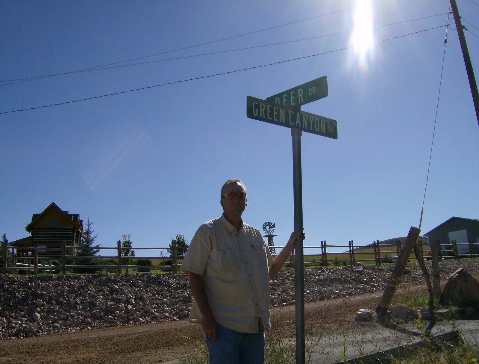
| Green Canyon |
 |
| Riding Double |
 |
| Dirt Road to Solitude |
 |
| The Woods are Lovely, Dark and Deep |
A Beach to Ourselves
 |
| Beach Boy and Girl |
 |
| Strollin' Along |
 |
| The Water is Fine! |
 |
| Meeting the Breakers |
 |
| A Couple of Nuts (Phylbert) |
 |
| Beach Beauty! |
 |
| Running a Barren Beach |


Saturday, August 14, 2010
Discoveries Close to Home
 My wife and I have been spending time exploring places close to home. It's been a real eye-opener. The Indian Trail is literally twenty minutes from our home. We have known about this trial for years. It is one of those places that you always drive by on the way to some other destination and say, "One day we ought to hike that trail." Well, one day finally arrived!
 I have to throw out a plug to those who have maintained this trail. It is in excellent shape; almost no litter and the bridges, shelter, and stabilized erosion and cliff areas are a nice touch. Thank you!
 We decided to start our hike at the trail head in Ogden Canyon and then end at 22nd street. We left a car at the 22nd street parking area and then drove to Ogden Canyon. This would allow us to come out over the ridge looking west toward Ogden valley. If we planned our time just right, we would enter the last part of the trail just as the sun was setting. We hiked quicker than we thought and ended up entering the valley with the sun an hour before actual sunset. Still it was nice. We were able to view Ogden valley, islands and mountains around the Great Salt Lake, and watch a ground squirrel sit on a large rock formation with exact stillness.
I will not give a detailed point by point of the hike. I'm sure that description can be found on other blogs or hiking web sites.
What I hope to do is give you a sense of the wonder and excitement we felt for finding a treasure so close to home. We hiked on a Friday afternoon. We did not run into another person until we came out on 22nd street. The whole time we were in the back canyons and switch backs, we had the trail to ourselves. I was a little surprised by this. Our timing must have been perfect. Most people were still at work. Those who were off work, were probably golfing, swimming, or dining out. I really enjoyed the solitude I felt as we entered the shadowy east facing side hills. In fact, most of the trail was in the shade. It gave the feeling of being in a primitive area. As I hiked I thought about the native Americans (Indians) who used this trail. It is told that they used it because the mouth of Ogden Canyon and parts of the canyon proper were impassable in the spring when Ogden River was full of snow melt. I wondered if they spent the night in the coolness of the canyon or if it was just a means of getting from one place to another.
The area is rugged for the most part. The only place that looked like an area were they might camp was in the small canyon as you start the hike. There's a small tributary that flows down this area and into the Ogden River. As we hiked through this area we saw two tents set up. In front of one of the tents was a sign telling us that the area was reserved for a Boy Scout troop. I thought of how the Scouts would hike into the area, build a fire, cook their dinner, and then tell campfire stories. I love campfire stories (especially the scary ones) and envisioned myself telling the Scouts about the Indians that used to camp on the very spot they were camping. I would tell them that when the white man came the Indians were forced to move higher into the rugged terrain of the surrounding mountains. I would tell them that on occasion an Indian is spotted by a hiker or that sometimes they would come down to people camping and trade. I would tell them that it is best to go to bed when told and stay in their tents--no running through the forest after dark. They never did find the one man who wandered up the trail after dark one night several years ago. All they ever found was his day pack.
 |
| Crossing a large rock slide area. |
 |
| My hiking partner in the foothill area. Her beautiful hair blending with the grasses. |
The switchbacks are not bad and after getting to the top of the trail we found the emergency shelter and got a view of the valley through the opening at the canyon mouth. We were now at the highest elevation of the trail, something like 6100 feet. I glanced over to the opposite mountain and wondered how we would cross over it. I could see no trail from this vantage. I guess I wanted to see a trail that just went up the side of the mountain. What I soon realized is that each side canyon had a trail that went back within it and then back out of it on the apposing west side. We went up and out of several of these side canyons as we made our way west toward the city of Ogden. That is what made it possible for us to stay in the shade the majority of the hike. It wasn't until we neared the mouth of the canyon that the trail slipped lower on the ridge and came out in the foothills and sage and sun.
I shared this trail with my wife and we both felt a peace and serenity under the large evergreens. I also had an awareness of how short our lives are. I imagined that the age of some of those trees was well beyond the allotted time I will spend on this planet. Their size also made me feel small and insignificant to a degree. Oh, I knew a good chainsaw could do some damage, but standing by some of the trunks made me feel powerless.
At one point we stopped for a snack. We could look down and see vehicles weaving their way around a corner on the canyon floor. It gave us a feeling of depth. I will admit, at that place I pondered what it would feel like to fall from such a place. My stomach twisted slightly. Even with that thought, there was never a place on the trail where I felt that sort of danger. I knew that I would have to be horsing around doing something stupid to end up falling.
I'm sure there are days when this trail receives pressure. It has to be a popular hike being so close to Ogden and the surrounding towns. I was glad that we hiked alone. As we came out of the canyons and into the foothills, we paused to look at the man made waterfall at the canyon mouth. It's nice, but because it isn't natural, its appeal is diminished for me. Still we stopped and looked. We took out the binoculars and scanned the valley. Then turned them to objects in the distance. Fremont Island, Antelope Island, Little Mountain, the Promontory Range and Willard bay were all scoped out. That's when we noticed the ground squirrel perched motionless on a large rock. I thought it rather odd that it was so still. Statuette like it looked out over the sage brush hills just above Rainbow Gardens. As we turned to finish our hike down to 22nd street parking area, a red fox walked across the trial. I watched as it walked up into the rocks and brush just ahead of us. I made a few squeaks on the back of my hand and it froze. I could see only its head poking up above a rock. My wife came down to see if she could see it. Eventually, it walked up the side of the hill and into the brush. It wasn't until we got home that it dawned on me that the reason the squirrel was so still is that it was probably watching the fox come up through its territory.
 |
| Cliff area. |
 |
| Looking toward Ogden from the 6100 foot level. |
 |
| The emergency shelter at the top of the hike. |
 |
| Large evergreen trunks make me feel small. |
 |
| There's a red fox in there somewhere. |
We drank the last few drops of water and then drove up the canyon to our other car. There was no sunset to see from the foothills. We had worried about hiking in the dark and made a poor estimate on how long it was going to take to complete the hike. Had we known, we would have spent more time in the deep, cool shadows of the canyons. When we met a home, we discussed the thins we saw and the feeling we had. We vowed to do the hike again, with the knowledge we have of just how long it takes to go from one end to the other. While the solitude was nice, we might just share the trail with someone else the next time we go. What do you say, you in?

 Happy hiking!


 Happy hiking!
Subscribe to:
Posts (Atom)